UN
9 Church Mews
£ 100,000
Description
We don't have a Description for this property.
- Bedrooms
- 2
- Bathrooms
- 0
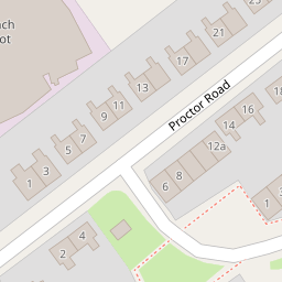

Leaflet © OpenStreetMap contributors
The heatmap indicates the level of crime in the area. The color of the heatmap indicates the crime severity and recency.
Metrics Year-on-Year
- Average area value
- 163,217.00 £Decreased by 7.22 %
- Average area rental value
- 594.00 £/moDecreased by 92.41 %
- Est rental Yield
- 4.37 %Decreased by 91.81 %
- Crime Rate
- 18.00 %Unchanged by 0.00 %
from 175,916.00 £
from 7,827.00 £/mo
from 53.39 %
from 18.00 %
Nearby Schools
| Name | Type | Ofsted | Distance |
|---|---|---|---|
| Grove Street Primary School | Community School | Requires improvement | 0.86 KM |
| St Anne'S Catholic Primary School | Voluntary Aided School | Good | 0.89 KM |
| Rock Ferry Children'S Centre | Children's Centre | 0.93 KM | |
| Rock Ferry Primary School | Community School | Good | 1.00 KM |
| St John'S Catholic Junior School | Voluntary Aided School | Good | 1.11 KM |
Images
Nearby Streets
| Name | Average Price | Average Sqft | Distance |
|---|---|---|---|
| St Peter's Road | £ 0 | 0 | 0.00 KM |
| Proctor Road | £ 170,000 | 0 | 0.00 KM |
| Power Road | £ 0 | 0 | 0.00 KM |
| Queens Road | £ 175,000 | 0 | 0.00 KM |
| Medway Road | £ 0 | 0 | 0.00 KM |
Nearby Transport
| Name | NLC | TLC | Distance |
|---|---|---|---|
| Rock Ferry | 2189 | RFY | 0.98 KM |
| Bebington | 2188 | BEB | 1.21 KM |
| Green Lane | 2218 | GNL | 2.21 KM |
| Port Sunlight | 2198 | PSL | 2.21 KM |
| Birkenhead Central | 2217 | BKC | 2.95 KM |
Nearby Listings
| Address | Price | Type | Score | Distance |
|---|---|---|---|---|
| Church Mews, Birkenhead, Merseyside, CH42 | £ 140,000 | BUY | 6 / 10 | 0.03 KM |
| New Chester Road, Birkenhead, Wirral | £ 290,000 | BUY | Unknown | 0.08 KM |
| Melville Avenue, Birkenhead, Merseyside, CH42 | £ 100,000 | BUY | Unknown | 0.11 KM |
| Alpha Drive, Birkenhead | £ 240,000 | BUY | 6 / 10 | 0.24 KM |
| Procter Road, Birkenhead, Wirral | £ 170,000 | BUY | 7 / 10 | 0.27 KM |
Nearby Properties
| Address | Price | Distance |
|---|---|---|
| 14 Church Mews | £ 99,950 | 0.00 KM |
| 3 Church Mews | £ 113,000 | 0.00 KM |
| 12 Church Mews | £ 101,000 | 0.00 KM |
| 29 Church Mews | £ 141,500 | 0.00 KM |
| 21 Church Mews | £ 84,654 | 0.00 KM |